
Models and Microsimulation
AMAV has vast experience in traffic assignments and transport models development, for the purpose of producing traffic and levels of service forecasts. The office uses existing models and develops special-purpose models. In addition, we specialize in running microsimulations which simulate the suggested system in high resolution.
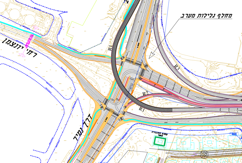
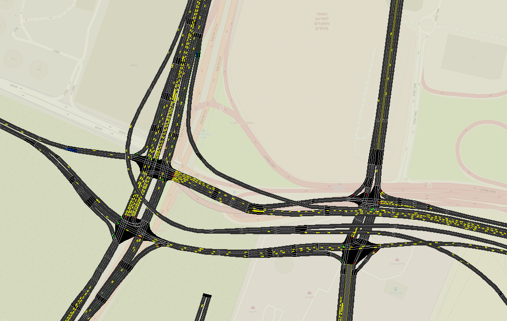
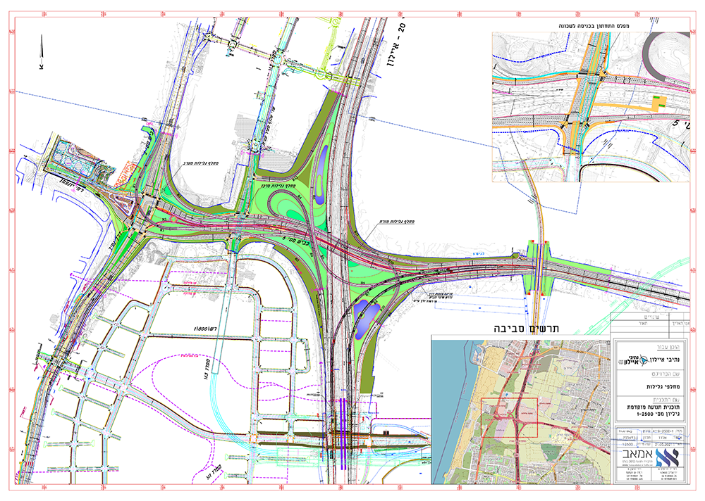
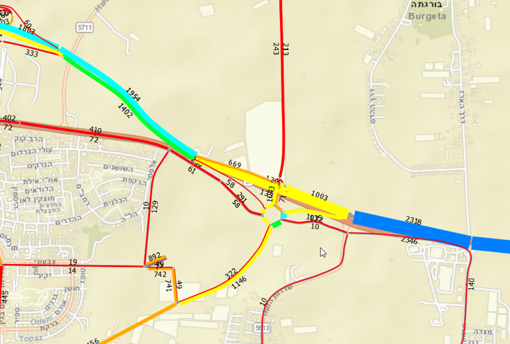
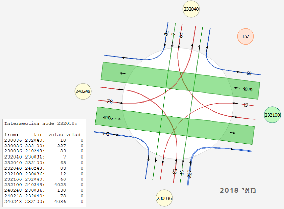
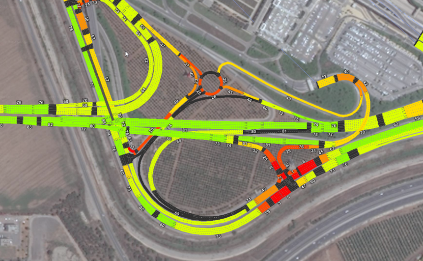
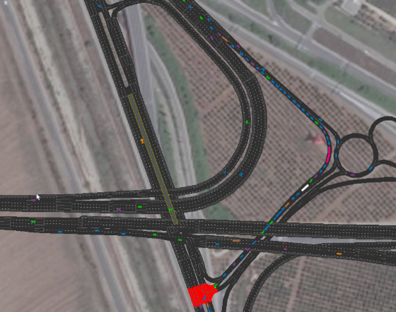
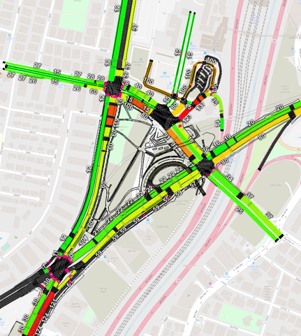
Glilot Interchanges – traffic forecasts and microsimulation
Between 2016-2018 AMAV provided traffic forecasts and used a microsimulation model to examine the suggested future system at the Glilot interchanges, for Ayalon Highways.
The Glilot Interchanges system is a transportation weak spot, the crossing of two national longitude routes 2 and 20 and the national latitude highway 5. The presence of offices and residential centers near the interchange required an in-depth analysis of the traffic aspects in the interchanges system.
The detailed microsimulation model allowed for a detailed analysis of the expected conflicts in the system and an examination of suggestions to improving the planning and minimizing the transportation conflicts.
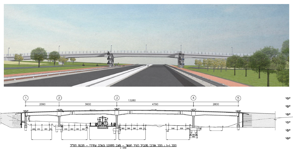
National Infrastructure Plan (TATAL) 43 and Route 53
TATAL 43 is a plan to expand and add interchanges highway 4, in the section between Hadarim and Hadera Stream interchanges.
This section of highway 4 goes through Israel’s center and is a central and important transportation artery. The plan’s objective is to improve the levels of service and safety of road users, arranging localities access, and using interchanges for latitude roads connections.
The plan includes constructing interchanges, widening the road to include 3-4 lanes instead of two, priority public transport infrastructure, farm roads, bicycle paths, and foot and bicycle bridges and crossings.
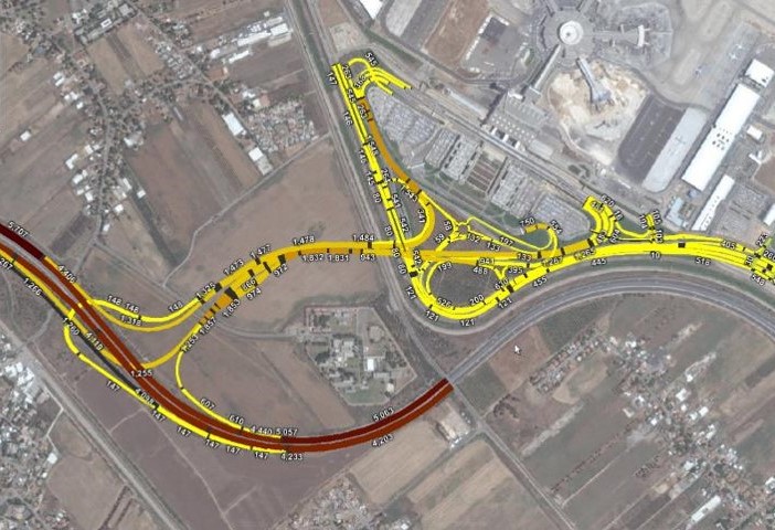
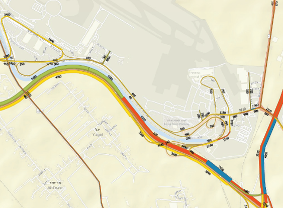
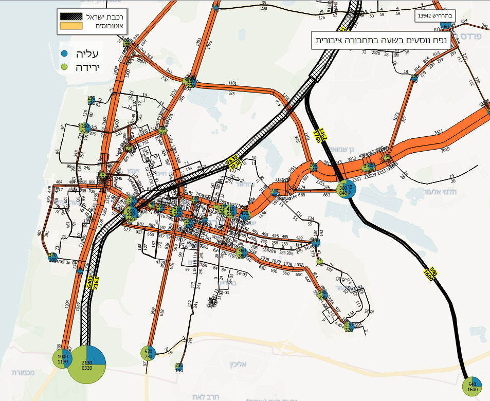
Ben Gurion Airport, Chabad Interchange- Microsimulation
AMAV performed a microsimulation model test in 2018-19, to examine the new suggested entrance system to Ben Gurion airport via Chabad interchange. The test objective was examining the system’s function in light of Terminal 3 security check activity and its internal functional system.
As part of the project we outlined the metropolitan transport model, while adding road sections and traffics zones, and creating a detailed origin-destination matrix that reflects the future airport development. In addition we calibrated the demand model to the airport traffic and its access according to updates traffic counts.
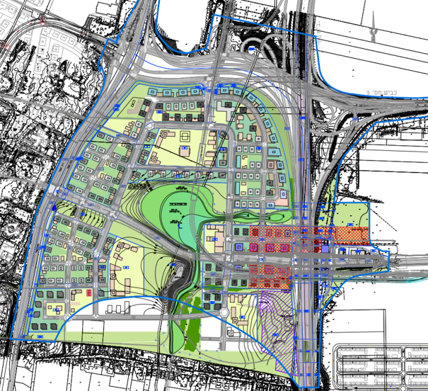
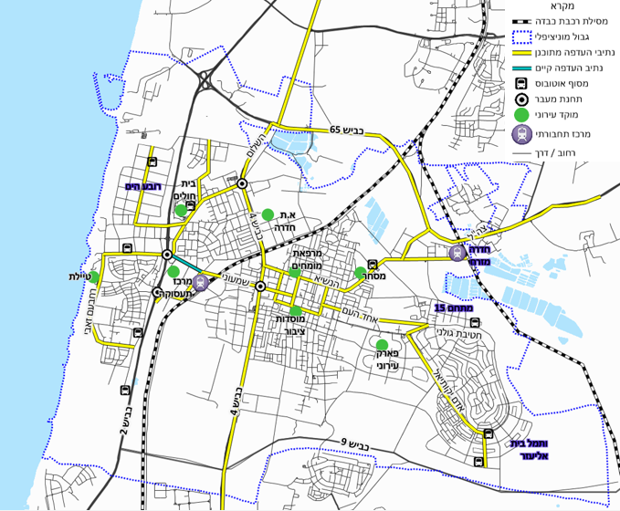
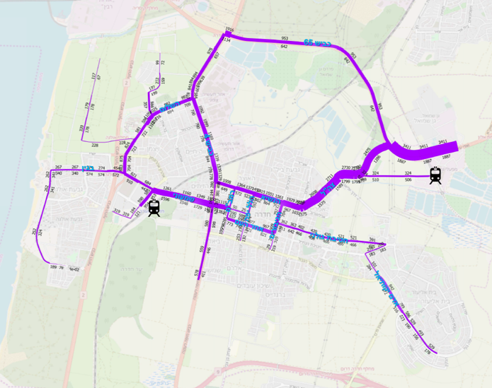
Hadera Master Plan and Forecasts
As part of drafting the Hadera transportation master plan we developed an urban-system targeted transport model. With the help of the model, we made traffic forecasts for the plan’s target year, including execution stages, and recommended specific transportation projects needed to realize the master plan’s objectives. The model examined a few transportation alternatives and made detailed assignments in order to examine specific issues.
The master plan guiding principles:
- developing an urban space that supports a variety of street traffic: bicycle, pedestrian, public and private transport;
- designing an urban space with an efficient street network that connects different parts of the city;
- creating a space that allows for efficient interurban connectivity for public transport and bicycle based commuting.
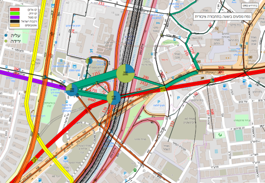
Savidor Train Complex – Microsimulation
AMAV performed a microsimulation model test of Savidor complex for Ayalon Highways.
The test’s objective was to examine the functioning of the complex, which includes the light rail purple line, a bus terminus, a kiss-and-ride parking lot, and motorcycle and taxi parking. In addition, we used the microsimulation to examine the functioning of junctions in and around the complex and pedestrian traffic in the space.